
Maps for Garmin based on OpenStreetMap


Maps with Digital Elevation Model (DEM)
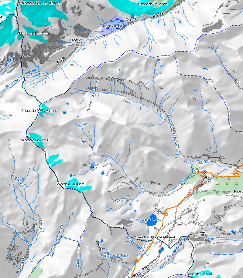
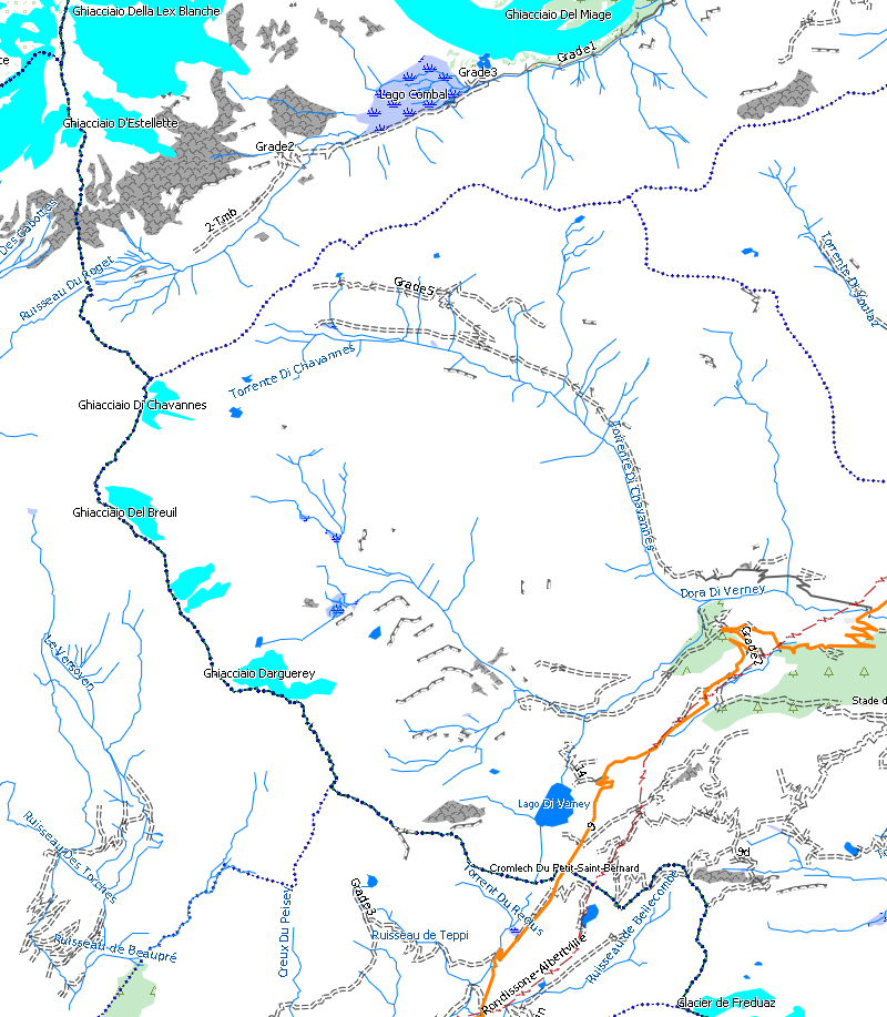
Information: a Digital Elevation Model is a file which contains information about land height in each point of the map. Garmin maps format can include a DEM, so that a hill shading like in the image below can be shown.
|
|
|
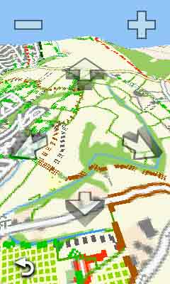
It is also possible with a DEM to see maps in 3D on BaseCamp and devices with such option (Oregon 600 for example).
|
|
|
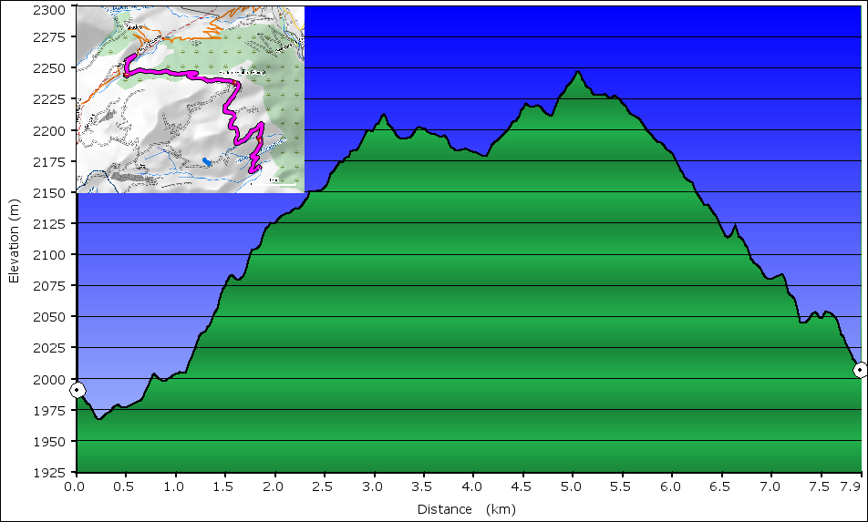
Additionally, maps with DEM are able to calculate vertical profil of routes created in a computer or in a GPS device (if the model has such capability).
If you have any comment about maps with DEM downloaded from this site, you can write it below:
Add Comment
Insert Bullet List
Please enter at least one item.
Item:
Item:
Item:
Item:
Item:
Insert Numeric List
Please enter at least one item.
Item:
Item:
Item:
Item:
Item:
Insert Link
Please enter the link of the website
Optionally you can add display text
Insert Email
Please enter the email address
Optionally add any display text
Insert Image
Please enter the link of the image
Insert YouTube Video
Please enter the link of the video
Image Upload
Privacy Policy
This policy contains information about your privacy. By posting, you are declaring that you understand this policy:
- Your name, rating, website address, town, country, state and comment will be publicly displayed if entered.
- Aside from the data entered into these form fields, other stored data about your comment will include:
- Your IP address (not displayed)
- The time/date of your submission (displayed)
- Your email address will not be shared. It is collected for only two reasons:
- Administrative purposes, should a need to contact you arise.
- To inform you of new comments, should you subscribe to receive notifications.
- A cookie may be set on your computer. This is used to remember your inputs. It will expire by itself.
This policy is subject to change at any time and without notice.
Terms and Conditions
These terms and conditions contain rules about posting comments. By submitting a comment, you are declaring that you agree with these rules:
- Although the administrator will attempt to moderate comments, it is impossible for every comment to have been moderated at any given time.
- You acknowledge that all comments express the views and opinions of the original author and not those of the administrator.
- You agree not to post any material which is knowingly false, obscene, hateful, threatening, harassing or invasive of a person's privacy.
- The administrator has the right to edit, move or remove any comment for any reason and without notice.
Failure to comply with these rules may result in being banned from submitting further comments.
These terms and conditions are subject to change at any time and without notice.
{"commentics_url":"\/\/alternativaslibres.org\/comments\/","page_id":58,"enabled_country":true,"country_id":0,"enabled_state":false,"state_id":0,"enabled_upload":true,"maximum_upload_amount":3,"maximum_upload_size":5,"maximum_upload_total":5,"captcha":false,"captcha_url":"","cmtx_wait_for_comment":"cmtx_wait_for_comment","lang_error_file_num":"A maximum of %d files are allowed to be uploaded","lang_error_file_size":"Please upload files no bigger than %.1f MB in size","lang_error_file_total":"The total size of all files must be less than %.1f MB","lang_error_file_type":"Only image file types are allowed to be uploaded","lang_text_loading":"Loading ..","lang_placeholder_country":"Country","lang_placeholder_state":"State","lang_text_country_first":"Please select a country first","lang_button_submit":"Add Comment","lang_button_preview":"Preview","lang_button_remove":"Remove","lang_button_processing":"Please Wait.."}
{"commentics_url":"\/\/alternativaslibres.org\/comments\/","language":"english"}
Comments (2)
Gracias
Yo uso OruxMaps con DEM en formato .hgt y DEM + Hdr, con estos archivos puedo sombrear los MapsForge y los gmapsupp.img. y puedo imitar o emular el sombreado de Garmin visto en la imagen de arriba. Pero el resultado es algo más tosco.
Los Topo muestran perfectamente las curvas de nivel.